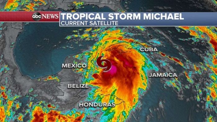
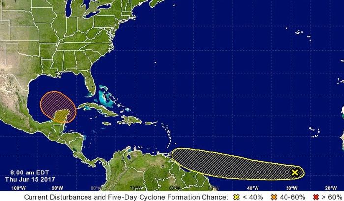
Forecasters say potential tropical system could enter the gulf next week – Forecasters say a potential tropical system could enter the Gulf of Mexico next week, prompting coastal communities to prepare for possible impacts. This system, currently in its early stages, has the potential to develop into a named storm, bringing with it heavy rainfall, strong winds, and even the threat of storm surge.
While the exact path and intensity of the system remain uncertain, meteorologists are closely monitoring its development and providing regular updates. The potential for significant impacts has prompted local authorities and emergency services to activate preparedness measures, urging residents to stay informed and take necessary precautions.
Potential Impacts
While it’s still too early to determine the exact path and intensity of the potential tropical system, it’s crucial to understand the potential impacts it could have on coastal areas. This system could bring a range of hazards, including heavy rainfall, strong winds, and storm surge, potentially causing significant disruptions to daily life and infrastructure.
Coastal Impacts
The potential tropical system could bring significant impacts to coastal areas, particularly those in the path of the storm. Heavy rainfall could lead to widespread flooding, especially in low-lying areas and areas with poor drainage. Strong winds could cause damage to property, uproot trees, and disrupt power lines.
Storm surge, the abnormal rise in sea level caused by the storm’s winds, could inundate coastal communities, leading to significant property damage and potential loss of life.
Transportation Disruptions
The potential tropical system could significantly disrupt transportation systems. Heavy rainfall and flooding could lead to road closures and delays, making it difficult for emergency responders and supplies to reach affected areas. High winds could damage bridges and other infrastructure, further hindering transportation.
Airports may also experience delays or closures due to strong winds and heavy rainfall.
Power and Communication Disruptions
Strong winds and heavy rainfall could damage power lines and other infrastructure, leading to widespread power outages. This could disrupt essential services like communication, transportation, and healthcare. Communication systems, including cell phone networks and internet services, could also be affected, making it difficult for people to stay informed and communicate with loved ones.
Regions Most Affected
The specific regions most affected by the potential tropical system will depend on its track and intensity. However, coastal areas along the Gulf of Mexico are likely to be most at risk, particularly those with a history of storm surge and flooding.
It’s crucial for residents in these areas to stay informed about the latest forecasts and prepare for potential impacts.
Do not overlook explore the latest data about More than 3,000 chemicals enter the body through food packaging, study finds.
Monitoring and Updates: Forecasters Say Potential Tropical System Could Enter The Gulf Next Week

Weather agencies play a crucial role in tracking the development and movement of potential tropical systems. They utilize sophisticated tools and techniques to monitor the system’s intensity, track its path, and provide timely updates to the public.
Accessing Reliable Updates and Forecasts, Forecasters say potential tropical system could enter the gulf next week
Staying informed about the system’s progress is essential. Several reliable sources provide regular updates and forecasts:
- National Hurricane Center (NHC):The NHC is the primary source for tropical cyclone information in the United States. Their website and social media platforms offer the latest advisories, forecasts, and storm tracks.
- National Weather Service (NWS):The NWS provides localized weather information, including tropical cyclone updates for specific regions. Their website and mobile app offer detailed forecasts and warnings.
- Local News Media:Local television and radio stations often provide live updates and reports from meteorologists during tropical events.
Key Events and Expected Updates
The following is a timeline of key events and expected updates regarding the potential tropical system:
- Initial Formation:The system is expected to form in the coming days. Weather agencies will closely monitor its development and provide regular updates on its intensity and potential track.
- Tropical Depression/Storm:If the system intensifies, it will be classified as a tropical depression or storm. At this stage, the NHC will issue advisories with detailed information about its location, wind speed, and expected path.
- Landfall:If the system makes landfall, weather agencies will provide warnings and advisories about potential impacts, including storm surge, heavy rainfall, and high winds.
- Post-Landfall:Even after landfall, weather agencies will continue to monitor the system’s remnants and provide updates on potential flooding and other hazards.
Historical Context

The Gulf of Mexico has a long history of being impacted by tropical storms and hurricanes. Understanding these past events helps us to better prepare for potential future threats.
Past Events and Lessons Learned
The Gulf region has experienced a variety of storms, ranging from minor tropical storms to major hurricanes. Each event has provided valuable lessons for preparedness and response. For example, Hurricane Katrina in 2005 highlighted the importance of evacuation planning and the vulnerability of coastal infrastructure.
Hurricane Harvey in 2017 demonstrated the devastating effects of prolonged heavy rainfall and flooding.
Historical Data on Storm Tracks and Intensity Levels
- The National Hurricane Center (NHC) maintains a comprehensive database of historical hurricane tracks and intensity levels.
- This data reveals patterns in storm formation, movement, and intensity.
- For instance, the Gulf of Mexico is known for producing a significant number of hurricanes during the peak season, which typically runs from August to October.
- Historical data also shows that storms can vary greatly in their intensity, with some remaining relatively weak while others rapidly intensify into powerful hurricanes.
End of Discussion
As the potential tropical system inches closer to the Gulf Coast, the focus shifts to preparedness and resilience. By understanding the potential impacts, staying informed through official channels, and taking proactive steps to safeguard themselves and their property, coastal communities can weather the storm, minimizing risks and ensuring the safety of everyone.
The situation is evolving, so it’s crucial to stay updated on the latest forecasts and follow guidance from local authorities.
FAQ Resource
What is the current status of the potential tropical system?
The system is currently in its early stages of development, with meteorologists monitoring its location, wind speed, and direction. More information about its potential development into a named storm will be provided as it evolves.
What are the potential impacts of a tropical storm or hurricane on the Gulf Coast?
Potential impacts include heavy rainfall, leading to flooding; strong winds causing damage to property; and storm surge, which can inundate coastal areas with high water levels. These impacts can disrupt transportation, power, and communication infrastructure.
What steps can I take to prepare for a potential tropical storm or hurricane?
Prepare a hurricane preparedness kit with essential supplies like water, non-perishable food, first aid supplies, batteries, and a battery-powered radio. Secure loose objects outdoors and review your evacuation plan if you live in a vulnerable area. Stay informed about the latest weather updates and follow the guidance of local authorities.
 CentralPoint Latest News


